Experience trails in the Schlick 2000
Hiking around the Kalkkögel
The Schlick 2000 hiking centre is already worth a visit due to its extraordinary nature and the impressive distant view - from the Stubai to the Zillertal Alps - on the Kreuzjoch and on the panorama platform "StubaiBlick". The network of adventure trails from the mountain station down to the valley, newly created in recent years, adds to the fun and entertainment for the whole family.
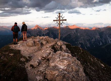
During a sporty day around the fascinating mountain range of the Kalkkögel - also known as the North Tyrolean Dolomites - a visit to the "StubaiBlick" viewing platform, which is a truly fabulous place thanks to the breathtaking distant view, is not to be missed. Pleasure hikers take the opportunity to master the first ascent with the gondola lift and then set off on a mountain hike from the Froneben middle station or the Kreuzjoch mountain station and discover the breathtaking mountain world or multi-faceted and exciting adventure trails for young & old.
Every Thursday from 6 June to 3 October 2024, a hiking guide will take you to the most beautiful places in the Schlick 2000 hiking area.
The hike is free of charge and takes place in all weathers. The hiking destination will be decided on site at short notice
(depending on group size, fitness and surefootedness).
Meeting point every Thursday, 9:00 am at the Schlick 2000 valley station


Tours & hikes from the Froneben middle station
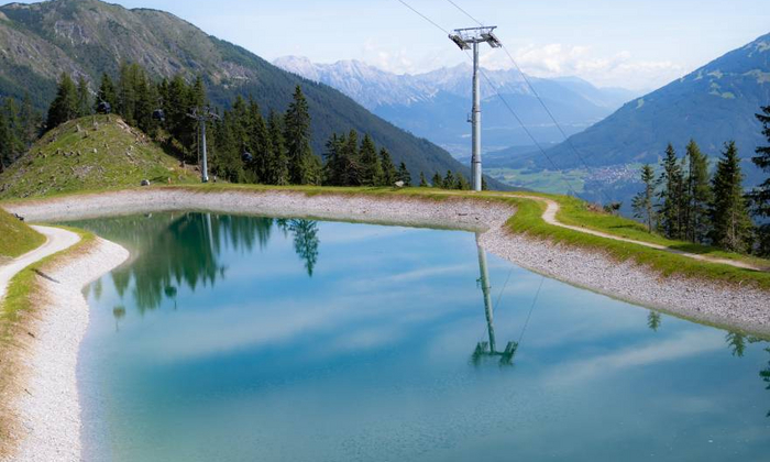
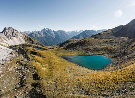
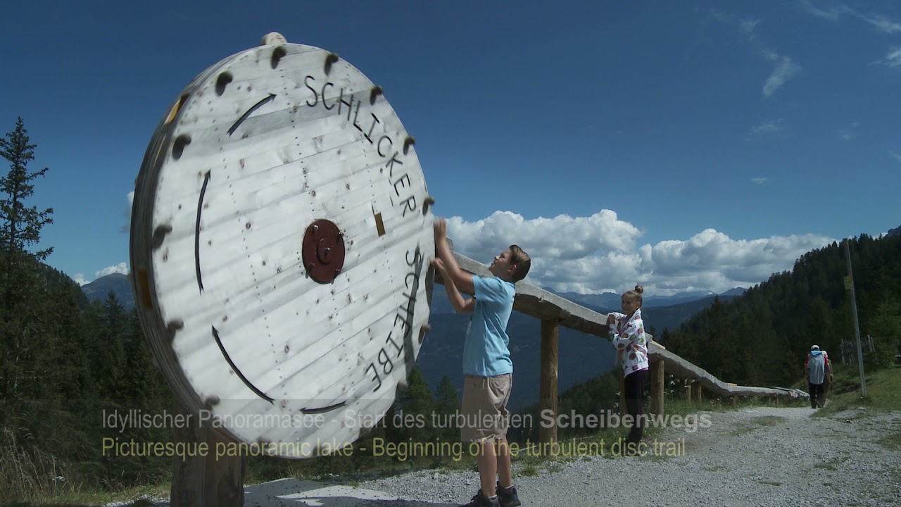
The trail leads from the Froneben middle station via the Scheibenweg (no. 6) to the Panoramasee lake. Continue to the Schickeralm via the Abendweide (no. 5). Once there, return a little way back and then at the Panoramasee to the Galtalm (no. 10). Return via trail no. 9 from the Galtalm to the Froneben middle station. Easy hike from alpine pasture to alpine pasture.
Duration: approx. 2 ½ - 3 hours
From the Froneben middle station, the trail leads over the Schlickerboden (no. 19) to the Bergler Bründl and the Pfarrachalm (no. 18). From the Pfarrachalm via Plöven down to the Schlick valley station.
Duration: approx. 4 ¾ hours (ascent and descent)
From the Froneben middle station, the trail continues via the Galtalm (no. 9) to the Kreuzjoch mountain station (no. 12).
Duration: approx. 2 ½ hours
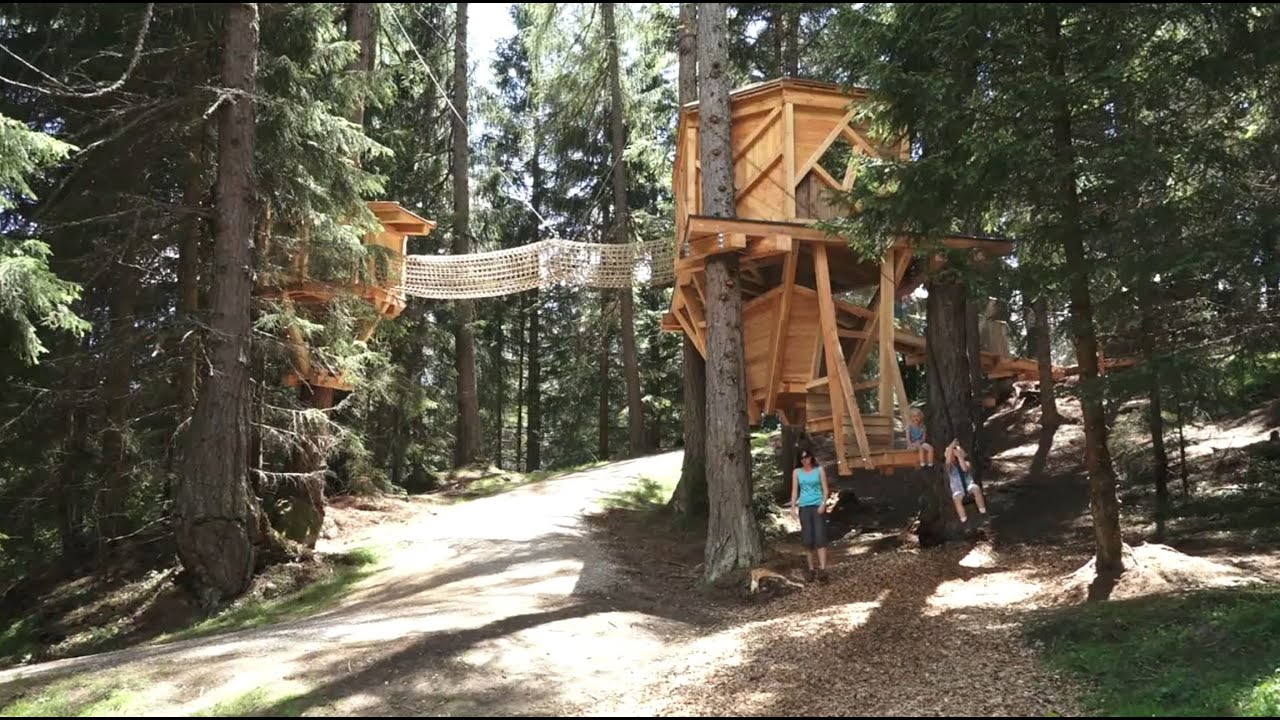
From the middle station via the tree house trail (no. 7) to Vergör and back to the valley station.
Duration: approx. 1 ½ hours.
Initially via the Scheibenweg (no. 6) to the panoramic lake and then through the larch meadows of the Schlickerboden (Abendweide no. 5), along to the Schlickeralm. Particularly suitable for families.
Duration: approx. 1 ½ hours.
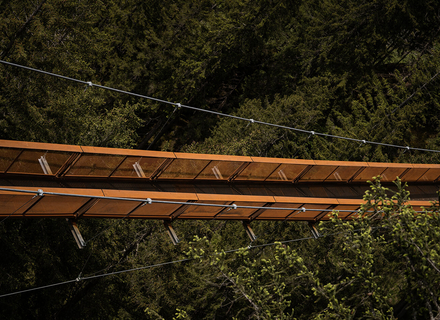
From the Froneben middle station via the tree house trail (no. 7) to the Alpengasthaus Vergör. From there, continue on trail no. 21 towards Gschmitz and Pfurtschell. After Pfurtschell, follow the "Sunnenseit'n Weg" signs to the suspension bridge and the "Neustiftblick" natural spectacle. After the suspension bridge, continue in the direction of Neustift. All details can be found here.
Duration: to the suspension bridge approx. 2 hours.
Tours & hikes from the Kreuzjoch mountain station
Up to the summit of the Kreuzjoch.
Duration: there and back approx. 1 hour - trail no. 1
The ascent to the Sennjoch is via the south side of the Kreuzjoch, the descent is via the north side (no. 2)
Duration: approx. 1 ½ hours.
The ascent to the Sennjoch (no. 2 and 3) takes place via the north side of the Kreuzjoch, from there it goes to the Starkenburgerhütte. Continue towards Hoher Burgstall and via the Schlicker Schartl to the Burgstalljoch (no. 15) back to the Sennjoch. Descent to the mountain station via the north side of Kreuzjoch.
Duration: approx. 4 hours.
From the Kreuzjoch mountain station, hike along the gently ascending panoramic trail towards the Starkenburger Hütte (no. 3). After the Sennjoch hut, follow the signs for Hoher Burgstall (no. 14). The trail leads up over the ridge, branches off to the right and passes under the south face of the Niederer Burgstall. The path then leads through a well-secured rocky gully and winds its way up to the summit of Hoher Burgstall, the last passage directly over the rocky ridge. The descent is via the south side of the summit to Starkenburger Hütte (2,237 m). From the hut, the trail climbs approx. 300 m back to the Schlick 2000 mountain station.
Duration: approx. 3 ½ hours
Route A: Via the nature trail (no. 4) to the Schlickeralm and from there via the Abendweide and Scheibenweg to the Froneben middle station (no. 5 and 6). Duration: approx. 3 hours
Route B: Up to the Sennjoch (No. 3) and from there to the Starkenburger Hütte. Via the Kaserstattalm, Knappenhütte and Galtalm to the Froneben middle station. duration : approx. 4 ½ hours
Via the south side of the Kreuzjoch to the Galtbergbahn mountain station (no. 12). From there, either take the 10-seater gondola lift to the middle station or continue via trail no. 10 and no. 9 to the Froneben middle station.
Duration: approx. 2 ½ hours
Via the south side of the Kreuzjoch to the Knappenhütte. From there to the Galtalm and down to Vergör. From Vergör back to the valley station.
Duration: approx. 3 ½ hours
Tours & hikes from the Galtbergbahn mountain station
From the mountain station of the 10-seater Galtberg cable car, always slightly downhill past the Galtalmsee lake to the panorama lake (no. 10).
Duration: approx. 1 hour.
From the mountain station of the 10-seater Galtbergbahn to the Galtalm (no. 10).
Duration: approx. 15 min.
From the Galtbergbahn mountain station via the south side of the Kreuzjoch, always uphill towards the Kreuzjoch mountain station.
Duration: approx. 1.5 hours.
Overview map hiking area

Classification of hiking trails
Yellow hiking trails are easy trails. Well marked, wide, moderately steep, not exposed, safe to walk on even in bad weather. Hiking trails for everyone, including children and older people, with suitable footwear and hiking equipment.
Red mountain trails are moderately difficult mountain trails. Well marked, narrow, often steep, sometimes exposed and require hiking experience in bad weather. Short secured climbing passages possible. Sure-footedness and hiking equipment required.
Black mountain trails are difficult mountain trails. Well marked, narrow, completely or partly very steep, often exposed. Dangerous in bad weather. Paths with longer secured climbing passages. Sure-footedness required. Only for fit mountaineers with a good head for heights and alpine experience and appropriate mountain equipment. Via ferratas are classified as black mountain trails.
Interactive map


Sommer in der Schlick 2000
Stubai Baumhausweg