Via Ferrata Höllenrachen
Important Infomation
Climbing Time
00:30 h
Walk Time Approach
01:30 h
Walk Time Descent
01:00 h
altitude meters uphill
30 hm
Sea Level From
750 hm
Sea Level Approach
2175 hm
highest point
2205 hm
Difficulty
B/C
Exposition
North East
Puplic transport:
From Innsbruck main station directly to Neustift village center, from the Tourist Board Stubai building continue with the Oberbergtal shuttle to Oberiss Alm.
Trip to by car:
The tour starts at the Oberissalm in Oberberg valley which can be reached from Neustift-Milders. Turn right in Milders and follow the street for 9 kilometers to its end at Oberissalm.
Parking:
You can park there for about 5 Euros a day or hire the shuttle service (call +43 5226 3500).
Approach:
From the car park at the Oberiss Alm to the Franz Senn Hut (approx. 1¼ hours). From there, follow the Alpeiner Bach stream through the flat valley. Turn left at the first step in the terrain (path) and you soon reach the start (visible steel cable with red markers).
Descent:
From the end of the steel cable keep slightly left to get back onto the 131 path and ascend to the Franz Senn Hut.
Best Season:
Jan
Feb
Mar
Apr
May
Jun
Jul
Aug
Sep
Oct
Nov
Dec
Altitude Profile
Weather
Description
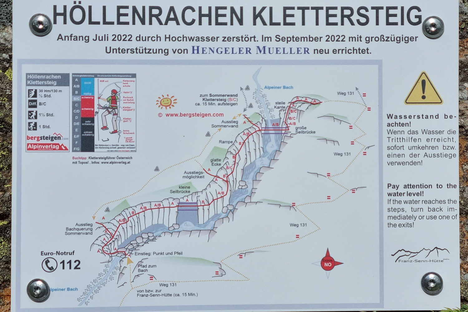
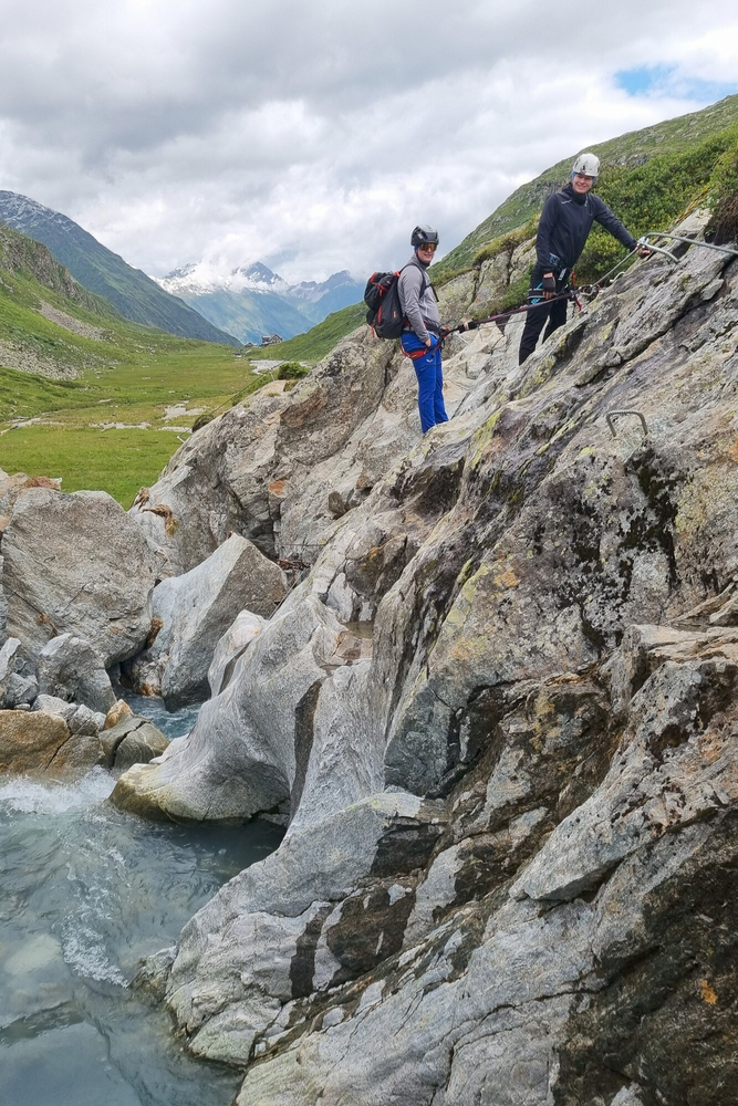
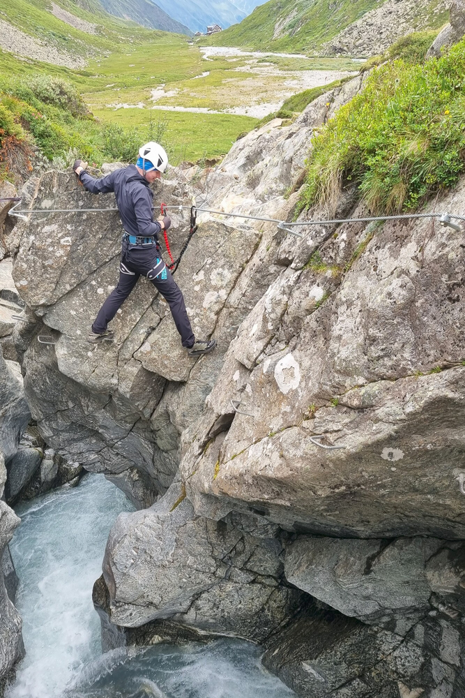
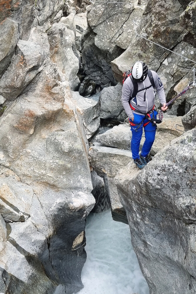
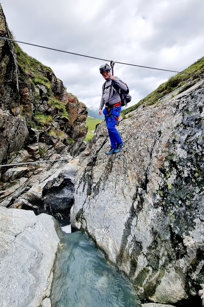
A mountain stream via ferrata, which is peppered with spectacular spots and in part even runs underground, just above the torrent.
The Höllenrachen (“hell’s throat”) via ferrata was completely rebuilt following the collapse of the famous and notorious “Hexenkessel” or “cauldron” (previously an underground crossing, E). The new route runs along the south-eastern side of the brook, crossing it at the end on a rope bridge. The builders reduced the difficulty level to B/C, opening this via ferrata up to a much wider audience. You climb upstream for much longer (approx. 130 metres of climbing) and often come really close to the roaring floods of the travelling glacial brook. A fantastic, impressive via ferrata by a brook, which you can also combine with a lovely hike.Times / height differences:
Approach: 15 - 20 min.
Via ferrata: 20 min.
Descent: 15 - 30 min.
Starting point: Franz Senn Hut, 2147 m
Precise route description:
See topo: Cross the brook (A), then you always traverse along the brook (A/B and briefly B) until you reach the first, short rope bridge. Afterwards, head around a corner (B) to easy terrain (A/B). Continue uphill, around a smooth corner (B/C) to a sloping ramp (B). Then easier again to the large rope bridge (A/B). Over the bridge and briefly left (A/B) to the steep ledge, on which you go up (B/C; steps also on the right side of the ledge) to easier terrain. Traverse (A) right at the end of the steel cable.
Attention:
Pay attention to the water level! If the water level reaches the steps, turn back immediately or use one of the exits!