Winter hiking trail Galtalm (15b)
ważne informacje
Długość trasy
4 km
Całkowity czas trwania trasy
02:00 h
Wysokość metry pod górę
271 hm
Metry wysokości w dół
271 hm
Czas pod górę
01:00 h
Czas w dół
01:00 h
Najwyższy punkt
1633 hm
Trudność
średnia
Wytrzymałość
3/6
Umiejętność
3/6
punkt początkowy:
Mittelstation Froneben/Bruggeralm
punkt końcowy:
Galtalm
warunek ścieżki:
Breiter, auch als Fahrweg genützter Winterwanderweg
sprzęt:
Sehr gute Schuhe mit Profilsohle (bei Vereisung Grödel empfohlen), der Witterung angepasste Kleidung
najlepsza pora roku:
Sty
Luty
Mar
Kwie
Maj
Cze
Lip
Sie
Wrz
Paź
List
Grud
profil wysokościowy
pogoda
opis
On the sunny side of the Schlick on the way to the Galtalm
Walking Time: approx. 2 hoursLength: 4 km (total)
Difference in Altitude: 271 m
Start / Finish: Froneben Intermediate Station
Parking: Valley Station Schlick 2000
Rest Points: Schlickeralm (1,643 m), Fronebenalm (1,306 m), Bruggeralm (1,350 m)
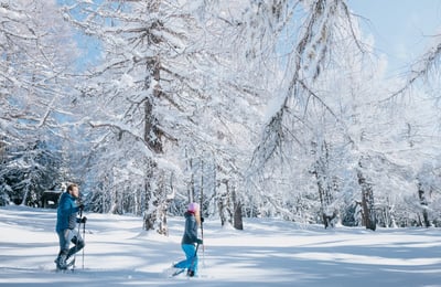
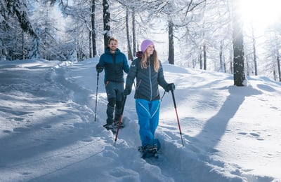
The winter hiking trail Galtalm is located in the Schlick 2000 ski area. This sunny trail starts at the middle station Froneben, passes by the Bruggeralm, and ends at the Galtalm. It takes about 1 hour to reach the Galtalm. A special highlight of this trail is that it passes under the ski slope through a tunnel. After a relaxing break at the Galtalm, you follow the same path back, either to the Bruggeralm or to the middle station Froneben. From there, you can watch the skiers making their tracks in the snow on your way back, and then enjoy a leisurely cable car ride down from the middle station Froneben. This winter hiking trail is also suitable for ski tourers.