Stubai Express
ważne informacje
Długość trasy
23 km
Wysokość metry pod górę
1240 hm
Metry wysokości w dół
1240 hm
Najwyższy punkt
1403 hm
Trudność
średnia
Wytrzymałość
4/6
Umiejętność
4/6
podróż transportem publicznym:
Direct bus connection with the Regiobus line 590 to Neustift, bus stop "Neustift Dorf"
podróż samochodem:
Via the Brenner motorway exit Schönberg, continue to Neustift
parking:
Parking in Neustift after the roundabout at the leisure centre or in the "Bachertal" car park (subject to charge)
punkt początkowy:
Village squarez Neustift
punkt końcowy:
Village square Neustift
najlepsza pora roku:
Sty
Luty
Mar
Kwie
Maj
Cze
Lip
Sie
Wrz
Paź
List
Grud
profil wysokościowy
pogoda
opis
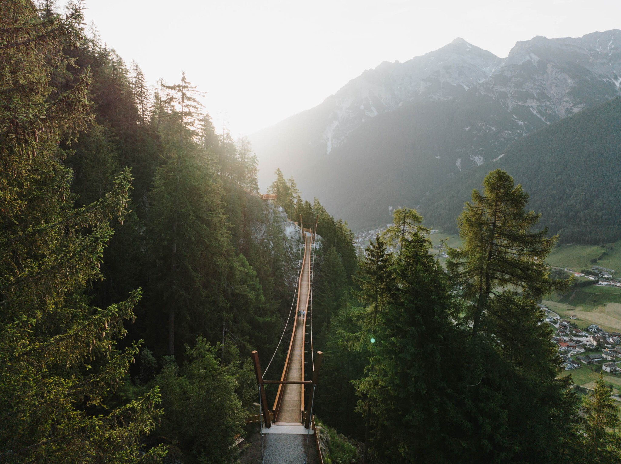
you cycle around Neustift on fantastic and not too difficult trails
The route starts in Neustift in the village centre, then follows easy trails along the Franz-Senn-Weg to Milders. There you cross the valley floor once and switch to the "sunny side" of the Stubaital. A short, steep trail leads to Forchach (1,300 m) and on to the Kartnallhöfe farms. After a short downhill, the route climbs around 200 metres up to the highlight of the K15, the new 105-metre-long suspension bridge, which offers spectacular views of the Stubai mountains. At Pfurtschell (1,300 m), the descent begins over the Omesberg to Kampl, along the Höhlebach stream uphill again and along a short forest path into the Pinnistal valley. The contemplation trail with numerous stations leads through marvellous forest and mountain pine terrain to the Issenangeralm. From there, the route is identical to the Stubai HIGH TRAIL on a fast trail past the Herzebner Almen back to Neder, with a short asphalt section to the village centre of Neustift at the end.