Stubai Run Part 1
ważne informacje
Długość trasy
13.2 km
Wysokość metry pod górę
327 hm
Metry wysokości w dół
327 hm
Najwyższy punkt
1139 hm
Trudność
trudna
Wytrzymałość
3/6
Umiejętność
2/6
podróż transportem publicznym:
Innsbruck main station, continue with the Stubaitalbahn or by bus to Fulpmes.
podróż samochodem:
From the olympic city Innsbruck the Stubai valley is accessible in 20 minutes via Brenner motorway, exit Schönberg forward to Fulpmes. The valley station Schlick2000 is well signposted in Fulpmes.
parking:
Car park at the Schlick 2000 valley station.
punkt początkowy:
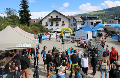
valley station Schlick 2000
punkt końcowy:
valley station Schlick 2000
stan gleby:
Asphalt (very little), gravel paths, forest paths
sprzęt:
Running shoes
najlepsza pora roku:
Sty
Luty
Mar
Kwie
Maj
Cze
Lip
Sie
Wrz
Paź
List
Grud
profil wysokościowy
pogoda
opis
Wonderful but quite challenging running route at the near end of Stubai.
The first section of the tour through Stubai begins at the Schlick 2000 valley station at the uppermost private house. Here you make your way up the valley to the Schlickerbach. Cross at the second bridge and then always keep to the left. The route leads past the chapel in Plöven climbing steadily uphill to Lüdritzsteig. From here, the path is mostly flat with slight ups and downs until just outside of the village of Telfe. The path then continues on the flat forest path with lovely views along the Telfeser meadow to the Brandeck bus stop. From here return back on the same path to the Schlick 2000 valley station.
The first section of the tour through Stubai begins at the Schlick 2000 valley station at the uppermost private house. Here you make your way up the valley to the Schlickerbach. Cross at the second bridge and then always keep to the left. The route leads past the chapel in Plöven climbing steadily uphill to Lüdritzsteig. From here, the path is mostly flat with slight ups and downs until just outside of the village of Telfe. The path then continues on the flat forest path with lovely views along the Telfeser meadow to the Brandeck bus stop. From here return back on the same path to the Schlick 2000 valley station.